
History
The Chumash People
saxipak’a (sa-hi-pa-ca) – Once Upon a Time
Adapted from The Chumash People: Materials for Teachers and Students. Santa Barbara Museum of Natural History, 1991 and personal communications Marianne Para June 13, 2022.
hutash, the Earth Mother, created the first Chumash people on the island of limuw, now known as Santa Cruz Island. They were made from the seeds of a magic plant, known in the Barbareño Chumash language as molo’wot, and in English as wild cucumber.
hutash was married to the alchupo’osh, Sky Snake, the Milky Way, who could make lightning bolts with his tongue. One day he decided to make a gift to the Chumash people. He sent down a bolt of lightning that started a fire. After this, people kept fires burning so that they could keep warm and cook their food.
After alchupo’osh gave them fire, the Chumash people lived more comfortably. More people were born each year and their villages got bigger and bigger. limuw was getting crowded. And the noise people made was starting to annoy hutash. It kept her awake at night. So, finally, she decided that some of the Chumash people had to move off the island. They would have to go to the mainland, where there weren’t any people living in those days.
But how were the people going to get across the water to the mainland? Finally, hutash had the idea of making a bridge out of a wishtoyo (rainbow). She made a very long, very high rainbow that stretched from the tallest mountain on limuw all the way to tzchimoos, the tall mountain near mishopshno (now known as Carpinteria).
hutash told the people to go across the rainbow bridge and to fill the whole world with people. So, the Chumash people started to go across the bridge. hutash told them to not look down when they crossed the bridge, because they could get dizzy and fall into the water. Some of them got across safely, but some did not listen and looked down. It was a long way down to the water, and the fog was swirling around and they became dizzy from fear and fell off the rainbow bridge, down through the fog and into the ocean. hutash felt very badly about this because she told them to cross the bridge. She did not want them to drown. To save them, she turned them into dolphins. Now the Chumash call the dolphins their brothers and sisters.
Through studies of anthropologists and archaeologists and a rich oral tradition, much of the way of life of the Chumash People has been rediscovered. The Chumash (many of whom still live in this region) have lived for thousands of years along the California coast. Their villages were on the Northern Channel Islands and on the mainland from Paso Robles to Malibu and far inland to the edge of the Central Valley. Over the centuries, the Chumash achieved great success in making a living from this land, and they had a complex political and economic system.

In 1959 and 1960, two thigh bones were excavated by Phil C. Orr, curator of anthropology and paleontology at the Santa Barbara Museum of Natural History, at Arlington Springs on Santa Rosa Island. Orr dubbed these remains as “Arlington Springs Man” and they were radiocarbon dated to 13,000 years BP. The remains of Arlington Springs man are considered to be the oldest-known skeletal remains in North America. The climate was cool and moist, and supported extensive pine forests. The Northern Channel Islands were joined in a contiguous land mass that scientists refer to as Santa Rosae, and the earliest people may have encountered woolly mammoths. The discovery of Arlington Springs man helped rewrite a key chapter of human history. Before then, most scientists thought the earliest people to reach the New World probably walked across a land bridge where the Bering Strait now separates Alaska from Siberia. Arlington Springs man helped contribute to more recent theories that people first migrated to the Americas by boat, following a coastal route along what is termed, the “Kelp Highway”.
Juan Rodriguez Cabrillo led the first European expedition to explore the California coast in 1542. He found numerous, flourishing “good looking” people living in villages, many large enough to be called towns. They possessed plank canoes and sophisticated manufacturing items.
Even today the San Marcos Foothills tells the story of its past. The Chumash people regularly harvested plants for food, clothing, tools, fiber, and medicine in the area that now includes the San Marcos Foothills Preserve. Archeological evidence indicates that there was a permanent settlement in the area dating to approximately 5,000-7,000K BP, plus intermittent campgrounds. Artifacts used for food processing have been found at two locations in the Preserve area, including a bedrock mortar (circular depression in a rock used by people for grinding food).
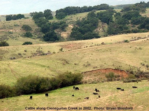
Records from the Santa Barbara Mission show that many present-day Chumash people can trace their ancestry back to kaswa’, a village located between the present-day Modoc Road and Highway 101 along Cieneguitas Creek. Kaswa’ is the closest village to the Preserve from which the names of the Chumash inhabitants were recorded. Today, some of the descendants of the people from kaswa’ helped save much of the Preserve from development, and they provide council to CIR and others about the Chumash people. They are the direct descendants of Mary Yee, the last person to speak the Barbareño Chumash language. By ancestral protocol and practice, the opinions of Chumash people with lineage from a nearby village have more weight in what happens at places like the Preserve than do Chumash who are not descended from such areas.
Spanish and Mexican Era
In the late 18th century, a string of mission churches was established along the coast of California, and the Santa Barbara Mission was founded in 1782. The Mission, along with the Presidio were the center of the Spanish colony in Santa Barbara. Due to increasing European settlement the Native American population declined by as much as 70 to 80 percent, particularly to disease.
In 1786, much of present-day Santa Barbara, including the San Marcos Foothills, was granted to the mission by the Spanish government. Mexico won independence from Spain in 1822 and later secularized the missions.
American Era

The foothills area was used primarily for cattle and sheep ranching as part of the large La Paloma Ranch, established after American sovereignty over California in 1847. From 1856 to 1913 ownership of various parcels in the foothill changed often and ownership and property boundaries were often unclear. The St. Vincent sisters purchased 620 acres on either side of Foothill Road and named it Cieneguitas Ranch. During the severe drought of the 1860s, much of their orchards, as well as sheep and cattle herds were decimated. By the early 20th century much of the La Paloma Ranch had been subdivided, including the 800 acres on the foothills. Between 1910 and 1925, the Flying A Studios, a Santa Barbara-based film company, reportedly filled scenes at the foothills.
Throughout the 20th century the ranch was sold several times and also leased for use as a dairy. Sheridan Wright purchased 800 acres in the foothills in 1913. His holdings extended from Hwy. 154 on the west to Barger Canyon on the east. Portions of his land would later become La Colina Park and the Trinity Baptist Church properties. Wright built and renovated houses and farm structures and kept a herd of cattle. In 1923 fire would char much of the foothills.
In 1934 the Wright property was foreclosed and its ownership would go to Harold Chase, Peter Cooper and W. Dickerson. Part of the land was leased to Antony Cavali to operate a dairy. The lower portion of the foothills was leased to Charles del Pozzo, who subleased it to the Loredo family to grow tomatoes, beans and melons.

Antonio Prevedello bought the 800-acre property from Harold Chase et al. in 1942. A dairy operated on the southern portion of the foothills, where milk products were processed from other dairies he owned. Following the Second World War, single-family housing was developed on parts of the property, while other parts were deeded to the state for road widening and to build a church.
Development Proposals and Preservation
From the 1970s on there were several proposals to develop the remaining 377 acres of the foothills. None of the proposals were approved, so the property remained in agricultural use. A 1998 proposal to develop an equestrian-themed community was denied approval, and was the impetus for the formation of the San Marcos Foothills Coalition (SMFC), whose goal would be to protect and preserve the precious foothill open space. Brooke Bulkley and Mark Holmgren were the founders of the organization and by the end of 1999, more than a dozen community organizations had joined the Coalition. Over the next few years, the SMFC worked tirelessly to raise awareness about the unique Foothills property and the need to preserve it. They sponsored lectures, slide shows and art exhibits. They produced a newsletter, raised funds and continued to add more organizations to the Coalition.
In 2001 the SMFC drafted “A Plan for the Preservation and Stewardship of San Marcos Foothills” that laid out the group’s goals for protecting the natural resources on the property. The plan focused on long term protection, enhancement and restoration of the Foothills. It also encompassed the historic, scenic and educational values of the San Marcos Foothills, and addressed public access and management of the property.
Near the end of 2005, Bermant Development Corporation (BDC) received approval from the County Board of Supervisors to develop 15 single family lots and five “affordable” condominiums on a portion of the property. In 2007 Santa Barbara Foothills LLC (managed by BDC) donated 200 acres of the property to the Trust for Public Land (TPL) as a charitable donation. TPL subsequently donated the 200 acres to County Parks to "ensure that the property will be preserved as open space for its biological, scenic and archaeological resources." In 2010, the SMFC partnered with Channel Islands Restoration (CIR) a local non-profit organization to restore habitat along Atascadero and Cieneguitas creeks. Funding for the projects was provided by the Goleta Valley Land Trust and the SMFC. As part of this process, CIR entered into a Memorandum of Agreement (MOA) with County Parks to perform the restoration work. In 2013, the SMFC and CIR began development of a San Marcos Foothills docent program.
In 2015, the SMFC began the process to "wind up" the organization and turn its responsibilities over to CIR. In December 2015, both organizations signed a memorandum of agreement whereby CIR "will maintain an interest in the Preserve and strive to continue the work of SMFC to oversee the Preserve's natural resources and prevent the loss of values of the Preserve to the public by taking such actions as it deems reasonable and appropriate.

In February 2016, County Parks and CIR renegotiated a revised MOA expanding CIR’s responsibility at the Preserve. Under the MOA, CIR serves as the Project Manager for habitat restoration and stewardship on the Preserve, which includes such activities as, removing non-native plants, planting natives, hosting volunteer groups, leading educational walks, conducting public tours, developing and implementing a docent program, generating community interest in conservation of the property, advising County Parks regarding recreational uses, interpretive signs, needed trail repairs and advocating for sensitive public recreational uses that are compatible with the biological, cultural and scenic resources of the Preserve.
In October of 2019, CIR initiated a process that led to the purchase of the 101-acre parcel located immediately to the West of the Preserve (known as the West Mesa) with the goal of adding it to the Preserve. This included meeting with the property owner, organizing a coalition of nonprofit supporters, producing a campaign video, and creating publicity. Within a year, CIR had raised $1.3 million dollars in donations and pledges toward the campaign. This included a single, $1,000,000 anonymous donation (followed later by an additional one) which gave the campaign a great deal of credibility. Soon a coalition of organizations and individuals came together (including CIR, Save San Marcos Foothills, and Chumash people) to raise the additional funds needed to meet the developer’s price.
In just over 90 days in 2021, the coalition raised $18.6 million to purchase the property. In 2023 the property ownership passed to the County of Santa Barbara.
In 2023, CIR signed a new memorandum of agreement with County Parks, giving CIR responsibility for restoration on the Preserve, as well as trail maintenance, educational programs (including creation of a docent program) and research activities.